
 Great News! Del Norte Coast Redwoods State Park - along with Tomales Bay and Samuel P. Taylor State Parks - have been removed from the closures list! In a press release last week, California State Parks announced that these three parks will remain open for an additional year on a trial basis in a partnership with the National Parks Service. And! Governor Jerry Brown has signed AB42 which allows some state parks to form partnerships with other non-profit organizations. Here's hoping a few more parks get a reprieve!
Del Norte Coast Redwoods SP is located six miles south of Crescent City - at the northern most part of the state - right on the ocean. Mist, moisture and fog envelope the old growth Redwood Trees, ferns, moss, mushrooms and other living things that enjoy a dense, dark habitat. Damnation Creek Trail - so named due to the "devil a time" early settlers had making their way through the thick forest - is a five mile round trip walk through the redwoods with a 1000 foot elevation gain. Even early trailblazer Jedediah Smith, (who has his own State Park named after him 15 miles up the road) had a dickens of a time in 1928 making his way through the foliage.
 Having spent the past three days in Redding's triple digit heat, Patty, Roxy and I welcomed the drastic drop in temperature. Although we had only traveled 130 miles west, it was cooler by 40 to 50 degrees. Sweatshirts replaced tank tops, while gooey trees under gray skies hid the sun.
Damnation Creek Trail is actually about five miles south of the official state park entrance and campground, with only a small sign in a turnout right on Highway 101 that accommodates a half dozen cars. We whizzed right by it... and right by the state park as well, ending up in Crescent City. Luckily the large visitors center was open, so we popped in. I asked the friendly folks behind the counter for directions to Del Norte Redwoods, pronouncing the "e" at the end of the word "norte" as per Spanish pronunciation. But, before I could finish my question they both interrupted me and said firmly, "Del Nort!," eliminating the "e." Then they smiled and said, "We're just simple folk here." Alrighty then! When in Del Nort.....

 The hike begins on a red earth path with ferns galore. The descent comes first on this trail, with lots of downhill switchbacks through virgin redwoods. If you visit in late spring, pink and purple rhododendron blossoms climb 30 feet overhead giving the impression of a tropical forest.
 Just before reaching the cliffs above the beach, two "triangle bridges" cross Damnation Creek. The first bridge is in competition with the blackberry vines for dominance. The second bridge has a tree resting her heavy limb on it's apex. I could almost hear the tree sigh and the bridge moan in this enchanted forest.
 The park brochure warns that the final length down to the beach is a tricky descent on the sometimes muddy and slippery bluffs and should only be undertaken by those confident in their abilities. But somewhere along the way someone has built a crude staircase. That's the route I took! And thus we were rewarded for our efforts in hiking down Damnation Creek's sometimes slippery 2.5 mile trail with our destination of ... Damnation Cove!
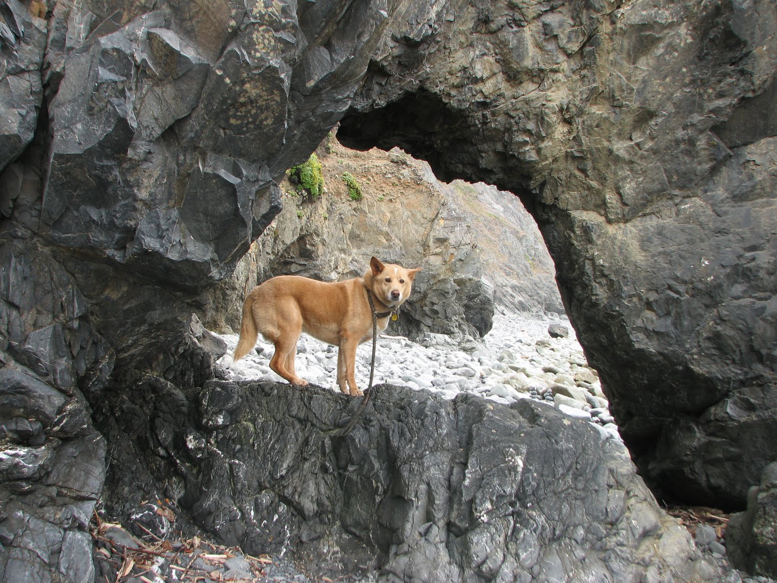
 A narrow rocky beach, tidepools, driftwood, succulents and climbing offer exploration while the tide is out.
Allow extra time going back since you'll be climbing 1000 feet on the 2.5 mile return. After crossing back over the triangle bridges I stopped here and there to appreciate some of the smaller life forms living in this majestic forest, such as wild oxalis and variety of mushrooms.


As we neared the end of our journey, a hint of sunlight poured through the redwoods. I was pooped, feeling a bit like the old Oak resting
 her branch on the bridge. A giant tree trunk seemed to be offering support, but it was still only mid-afternoon. Restaurants, a fantastic Indian Museum, and a giant blue ox awaited down the highway.
I must return in spring - now that the park is staying open - to see the rhododendrons. Until then, there's another 58 parks to visit.
Hope to see you there.
Lucy


