Thursday, May 31, 2012

GEORGE J. HATFIELD STATE RECREATION AREA: Trip #47 of 70

I drove southwest for twenty miles down country back roads lined with almond orchards from McConnell SRA to George Hatfield State Recreation Area. Hatfield is the last of the four San Joa-quin valley state recreation areas on the closure list, and like McConnell, will be remaining open.

Like McConnell, Hatfield SRA is on the Merced River and provides picnicking, fishing and swimming. It does not have camping facilities, but appears to more readily able to accommodate large picnic groups.

A Raven greeted me at the park entrance. The twenty mile change in geography had brought me to a slightly marshier environment, although the water fowl were completely absent on this early April afternoon.


From a financial, "save the parks" standpoint, Hatfield and McConnell recreation areas have essentially been handled as a single entity. Last week it was announced that enough money from a variety of sources was raised to temporarily keep both parks open.

In February Deidre Kelsey, District 4 Supervisor for Merced County, gave $2,500 of her special district funds as seed money for the Save Our River Parks group. Additional funds include $5,000 from the city of Newman, a $10,000 special district fund loan from Merced County and $20,000 from the State Parks Founda-tion. Several small donations from $20 to $100 also helped the group reach its goal.

But, this is just for the next twelve months. There is still uncertainty as to the fate of Hatfield a year from now. Merced County has kept open two favorite family recreation areas for another year, so get out there and enjoy them.


I hope to see you at the State Parks.


Lucy


This blog is dedicated to the memory of my Father, who loved reading maps, exploring alternate routes, and taking the road less traveled.

Alvin David Dick
April 28, 1926 - May 20, 2012

McCONNELL STATE RECREATION AREA: Trip #46 of 70

McConnell State Recreation Area is the third of four San Joaquin Valley rec-parks on the closure list. Surrounded by vineyards and almond orchards, the park is located south of Turlock on the banks of the Merced River, offering picnicking, camping, fishing and swimming.

In early winter, the East Merced Resource Conser-vation District was notified that they had until March 31 to raise $64,000 to keep both Mconnell SRA and neighbor-ing Hatfield SRA open for another year.

The deadline for fund raising was extended, and last week it was announced that enough money from a variety of sources was raised to temporarily keep the parks open. Hurray!

Last February Deidre Kelsey, District 4 Supervisor for Merced County, gave $2,500 of her special district funds as seed money for the Save Our River Parks group. Additional funds include $5,000 from the city of Newman, a $10,000 special district fund loan from Merced County and $20,000 from the State Parks Foundation. Several small donations from $20 to $100 also helped the group reach its goal. Double Hurray!

I parked my car at the shaded end of the campgrounds, where the campsites from the previous weekend still had their "Reserved" signs posted, a good indication that the park was still having decent attendance. A well maintained picnic area, a small outdoor amphitheatre and a marshy area loaded with birds - especially Woodpeckers - was nearby.

Additional picnic tables are scattered along the riverbank. Living in the Sierra Foothills, I am used to icy, snow-melt water temperatures even in late sum-mer. I stuck my foot into the Merced River and found it delightfully temper-ate. Except for inflatables and floaties, it is not suited for boating though. There are no boat ramps and it is shallow, especially in this drought year. Swimming, splashing and fishing for catfish, black bass and perch are the preferred activities here on the Merced.


It was high noon and I decided to stake out a table and have my lunch before heading down the road to check out Hatfield SRA. But, it seems this was the time the sprinklers were set to come on and water the lawn and picnic tables. At noon?

California's water history is a cyclical one of flood and drought. The San Joaquin valley has long grown large portions of our food crops. Water comes to much of the valley by way of aqueducts and reservoirs as there are few natural large bodies of water in this part of the state. Combine that with the central valley's triple digit summer heat, and water conser-vation has long been an issue. Those of us who have lived through many a drought year know that watering should be done in the morning or evening, not at noon!

My agitation was increased when I found a leaky hose dripping water at its connection. In my opinion, gold is not California's most precious resource, water is.

Well, nonetheless I'm glad the park is staying open. As Supervisor Kelsey said, "Keeping the parks open not only promotes recreation, but also prevents the isolated areas from becoming havens for criminals."


So, if they can just get a couple of new hose connections and reset the sprinkler timers, my feeling of happiness will be upgraded to one of being thrilled!


I hope to see you at the State Parks.


Lucy


This blog is dedicated to the memory of my Father, who loved reading maps, exploring alternate routes, and taking the road less traveled.

Alvin David Dick
April 28, 1926 - May 20, 2012

Tuesday, May 29, 2012

TURLOCK LAKE STATE RECREATION AREA: Trip #45 of 70

No doubt when you look at the photo to the right, the first place that comes to mind is Turlock, CA.

No? Me neither! Yet there it is out in the middle of nowhere: Turlock Lake State Recrea-tion Area. A clear blue lake, a shaded picnic ground and a pristine beach was inhabited on this day by no one except three pair of Canadian Geese and their offspring. And me.

Turlock Lake is the second of four San Joaquin Valley recreation areas on the closure list. After my initial surprise at finding this lovely spot out in the middle of sun scorched pasture lands, my second thought was, "What a shame this is closing." Cali-fornia's central valley and its infamous triple digit summer heat can use all the swim-ming holes it can get. This certainly qualified as more than a little swimming hole!

The park has twenty-six miles of shoreline and foothill country. Turlock Lake is on the south side. On the north side - just across the road - is the lower end of the Tuolumne River, with sixty-six campsites and put-ins for kayakers. Although less than a mile away, the terrain at the campsite is marshier and shaded, strikingly different from the lake area. A short, blackberry brambly hike along the river bank is accessible at the campground.


The fate of Turlock Lake is in the reluctant hands of the Turlock Irrigation District, (TID). TID owns the 3,500-acre park and stores part of its Tuolumne River water supply in it. They have been leasing it to California Parks and Recreation since 1950. The district has been reviewing submitted proposals, which include hiring a subcontractor to operate the park.

So! What to do? TID is under no legal obligation to keep the area open for recreation. But closing the facility would cost $345,000 in the first year – $260,000 for security fencing – and $80,000 or more annually to pay for basic maintenance and security.

Or, they could assume operations of the park for about $170,000 a year, plus approximately $278,000 in start-up costs. The state will likely take the picnic tables, signs and maintenance equipment so that would all need to be replaced, as well as maintaining existing structures.

Yet another option would be for TID to subsidize the state parks' continued operation of the lake. That would cost between $160,000 and $180,000 annually, with a miniscule rate hike for TID customers, but the park would likely still see reductions in service.

What a headache! Aren't State Parks supposed to be places where we can go to clear out the spaces between our ears and get away from all these yucky hassles? I suspect that even those parks on the closure list that are remaining open have had to jump through some pretty interesting legal and monetary hoops.

For the moment, I did let the wind blow away my troubles. I sat at a table and watched as the three pair of Geese parents hustled their goslings down to the water. Something had spooked them. The Buzzard on the fence post seemed curious as well.


TID was open to exploring any number of options and partnerships. At this writing I cannot find any information that indicates success, and barring an eleventh hour solution, this suprisingly lovely park will be closing.

I hope to see you at the State Parks.

Lucy


This blog is dedicated to the memory of my Father, who loved reading maps, exploring alternate routes, and taking the road less traveled.

Alvin David Dick
April 28, 1926 - May 20, 2012

Monday, May 28, 2012

BRANNAN ISLAND STATE RECREATION AREA: Trip #44 of 70

This post on Brannan Island State Recreation Area will be the first of four consecutive blogs on recreation areas in the San Joaquin Valley that are closing. As of this writing, it appears that Brannan Island will not escape closure, and the camping reservation organization "Reserve America" is not accepting reservations for after July 1.

Brannan Island is located in Rio Vista on the Sacramento-San Joaquin Delta. The delta is a maze of waterways offering boating, swimming, windsurfing and wildlife viewing on its numerous islands and marshes.

Aside from the boat ramps, not much of the delta river system can be seen from the campground. That being said, it is an immaculately groomed facility. Thick nautical rope is draped between posts, lining the roads, paths and picnic grounds. The parking lot at the boat ramp is huge, and I imagine on hot summer weekends it's packed.

But, the park has been winding down and preparing for closure for some time now. Windy Cove and Delta Meadows parking areas and restrooms are closed. Until closure, camping will only be available Friday, Saturday and Sunday nights.


Day use picnic and swimming areas have been drastically reduced. Group campsites are limited. Delta Meadows River Park Canoe Tours are no longer offered. The Rally Site is closed.


People can park at the boat ramp and walk into these areas, but all facilities have been closed. They must pack all items in and out and use the facilities at the boat ramp. And of course the Visitor Center is closed as well.

While Brannan Island is not a hiking park, it does provide a pleasant three mile foot path through the campgrounds, trees and shrubbery. Rabbits and I startled each other a few times on my walk.

It is of course, the outstand-ing water-oriented recreations that are the feature of this park. The way things stand, we have the month of June left to enjoy it. 'Tis our last to chance at Brannan Island to reel in striped bass, sturgeon, catfish, bluegill, perch and bullhead. One month left to view wildlife at Frank’s Tract, although I'm sure the beavers, muskrats, river otters, minks and 76 species of birds who dwell there are relieved that they will remain a protected wetland marsh.

As I drove away, the Ranger Hut had the words "Farewell Brannan Island," painted on it. I'm sure when it was painted, it was meant as a jolly goodbye, with an implied "Come Back Soon." I fear however, that the farewell now has a more permanent tone.


I hope to see you at some of these State Parks while we still have the opportunity.

Lucy

This blog is dedicated to the memory of my Father, who loved reading maps, exploring alternate routes, and taking the road less traveled.

Alvin David Dick
April 28, 1926 - May 20, 2012

Saturday, May 26, 2012

RUSSIAN GULCH STATE PARK: Trip #43 of 70

After visiting Point Cabrillo Light Station in the morning, Patty and I drove one mile down a windy but scenic Mendocino road to 
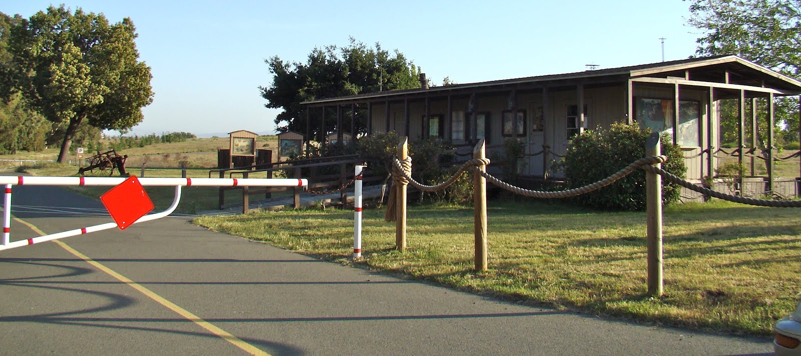
Russian Gulch State Park for a picnic lunch and a long hike. We passed a curvaceous bridge, and stopped at the park en-trance to pay our day use fee.

Before proceeding, we had a small problem that we hoped the ranger could help us with. The cap on our bottle of fruit juice had been screwed on too tightly at the factory. We couldn't open it. The ranger was a strong, burly fellow who was happy to help a couple of senior citizens with their dilemma. We watched as his face turned purple with effort, and finally - success!

He handed us a trail map. He didn't know if the park was staying open or not. I've found that the staff is often the last to know. We drove in, hoping to find a scenic spot for our picnic. Yes, I think this view will suffice!

Russian Gulch has several major features: a waterfall, a blow-hole and Fern Canyon. There are wildflowers galore, picnic sites, campsites, a beach and up to ten miles of hiking trails.

The blow-hole was a five minute walk from our picnic table, although as we often do, we easily tripled that amount of time by stopping to take pictures. A narrow path has been cut through the shoulder-high foliage. Sweet scented Cow Parsnip and bright red Mendo-cino Paintbrush dominated the wild-flowers on the blow-hole bluff.

The hole sits two hundred feet back from the edge of cliff. Scotch Broom and coastal plant life cover the walls of this sixty foot deep pit. Below, a tunnel has been formed through the rock by the constant pounding of waves against the headlands. At high tide you can hear the sound of the water rushing through the tunnel like a freight train before it reaches its final destination at the bottom of the hole.


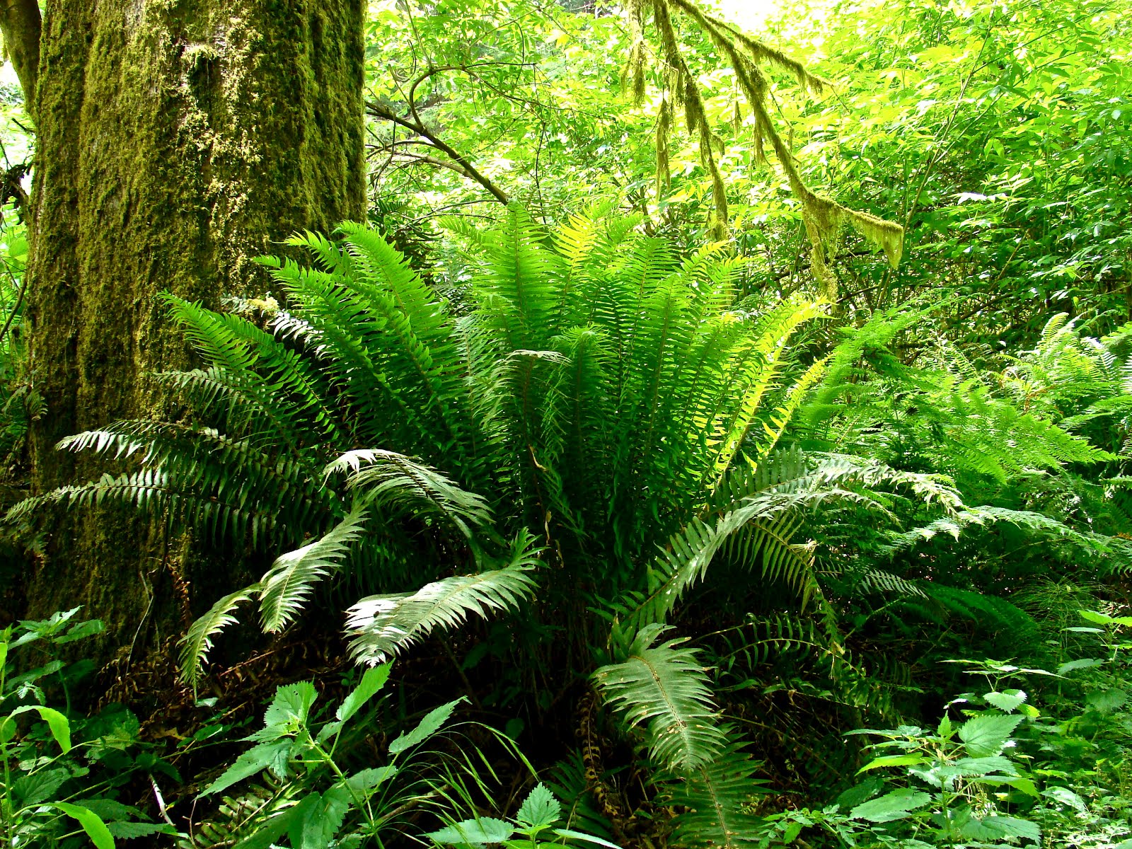
Next up was our hike. We followed a paved road for half a mile, through a few campsites, to the start of The Fern Canyon Trail. Hillsides were covered with the familiar Sword Fern surrounding Redwood Trees. We learned that the intriguing large clumps of wispy, spiky ferns with striped, bamboo-like stalks are called Horsetail Ferns.

I am often amazed how drastically the landscape and foliage can change in a matter of minutes. We had just left the marine headlands, and were now almost smothered by a dense redwood and fern jungle. I love California!

Russian Gulch was acquired in 1933 through gifts of money and land by A. Johnston and the County of Mendocino to match State Park funds. It is believed that the first white men to explore the rugged Mendocino coastline were Russian, hence the name to honor these early adventurers.

Our hike continued into the woods, with endless varieties of wildflowers, blackberries, and some sort of berry bush that we hadn't seen before: a Salmonberry!


The trail became steeper as we traveled further inland, but rewarded us with a foot-bridge leading to a thirty-six foot waterfall. Benches provided rest and an opportunity to be hypnotized by the falling water.

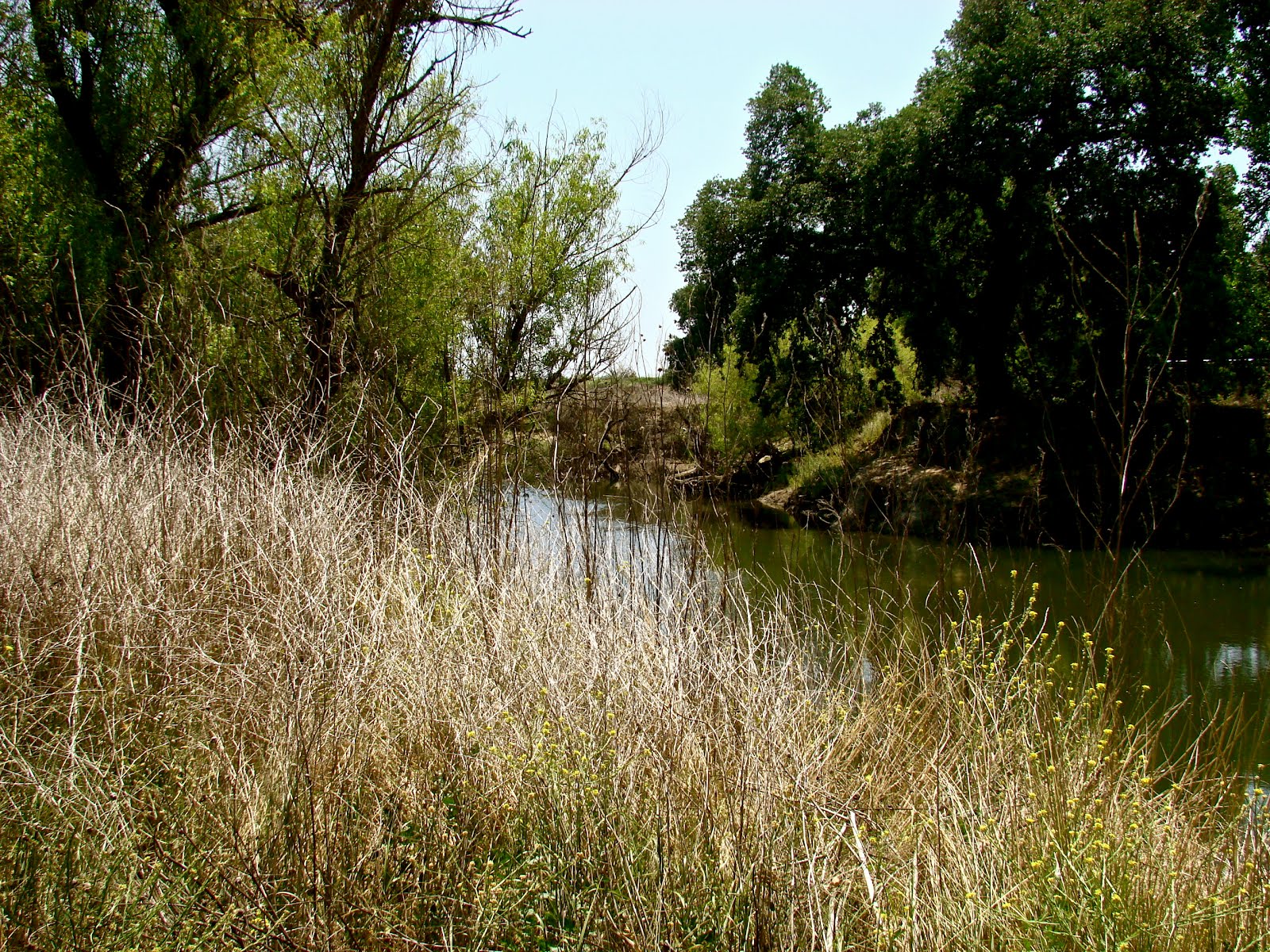
At this point we took a wrong turn on the path. Instead of looping back, we ended up on a service road on the peri-meter of the park. And while it added two to three miles to our journey, it was flat and easy walking. Once we realized our error, we could easily see where we were on the map. And lest we had any doubts, the road had well placed signposts with mileage and arrows.

On this back road there was new, different foliage to look at. We had entered yet another micro-environment. We were out of the forest and had blue sky overhead.

Best of all, wild pink Rhododendrons accompanied us the entire way. Russian Gulch State Park has easily slipped into my top ten favorites list!

I hope to see you at the State Parks.

Lucy

This blog is dedicated to the memory of my Father, who loved reading maps, exploring alternate routes, and taking the road less traveled.

Alvin David Dick
April 28, 1926 - May 20, 2012