Saturday, March 3, 2012

CANDLESTICK POINT STATE RECREATION AREA: TRIP #26 OF 70

In the 1960s and 70s I must have driven by Candlestick Point State Recreation Area a couple of hundred times on my way to a San Francisco Giants baseball game, never realizing there was a state park right across the street from the stadium.

Any outfielder who has ever been fooled by the direction of a high fly ball at Candlestick Park can vouch that the Point is known for its tricky winds. While the wind may be an outfielder's curse, it is what draws water sport enthusiasts to this point on the San Francisco Bay, especially windsurfers during the blustery late spring and summer months.

I felt an odd combination of excitement and nostalgia. I had just driven into the city over the Bay Bridge - yes - the same bridge that collapsed on the third day of the World Series between Oakland and San Francisco in the 1989 Loma Prieta Earthquake. The giddy feeling I get driving into San Francisco has been with me all my life, and I suppose at this point always will be. My nostalgia for those baseball days of Mays, McCovey and Marichal had already been reignited the night before when I coincidentally (or not) had watched the movie Money Ball.

No windsurfers were out today, but the park also offers hiking, jogging, bicycling, bird watching and picnicking. A one mile trail provides easy recreation. Folks can fish off of two long piers. Wooden shelters have information about local birds, and sur-round the tables to protect pic-nickers from the strong winds.

Candlestick Point was first born during World War II as 170 acres of landfill that was going to be used as a U.S. Navy shipyard. After the war, the landfill
remained, but without a purpose. Some of its neighbors found a purpose for it: an easy place to dump their garbage.

Other neighbors sought a different pur-pose. They wanted to turn it into a park with grass, trees, shrubs, flowers and habitat for migrating and seabirds. In 1973, the state legislature set aside $10 million to purchase the land. In 1977, the California Legislature voted to develop the land as the first urban state recreation area.


The late 1970s date explains why I never noticed the area as a state park. By that time my adult interests had changed. Excursions to the ballpark diminished, then disappeared. The San Francisco Giants were relegated to fond childhood memories.

Today on any given day, people come to exercise, fish, and just enjoy the experience of "getting away from it all." Candlestick Point is a treasured respite from city life. It is also valued as a community park with many frequent visitors from the nearby Bayview/Hunters Point neighorhoods.

Several office buildings and apartment complexes sit directly across the street. Unless chain link fencing is installed, I don't see how they can keep the casual pedestrian traffic out of Candlesitck if it closes. However, the simple barricading of the parking lot will be the singular thing that will make the park inaccessible to the rest of the public, save those few who have permits to park at nearby businesses. Private parking lots are only occasionally available at outrageous prices. San Francisco has never been a parking friendly town.
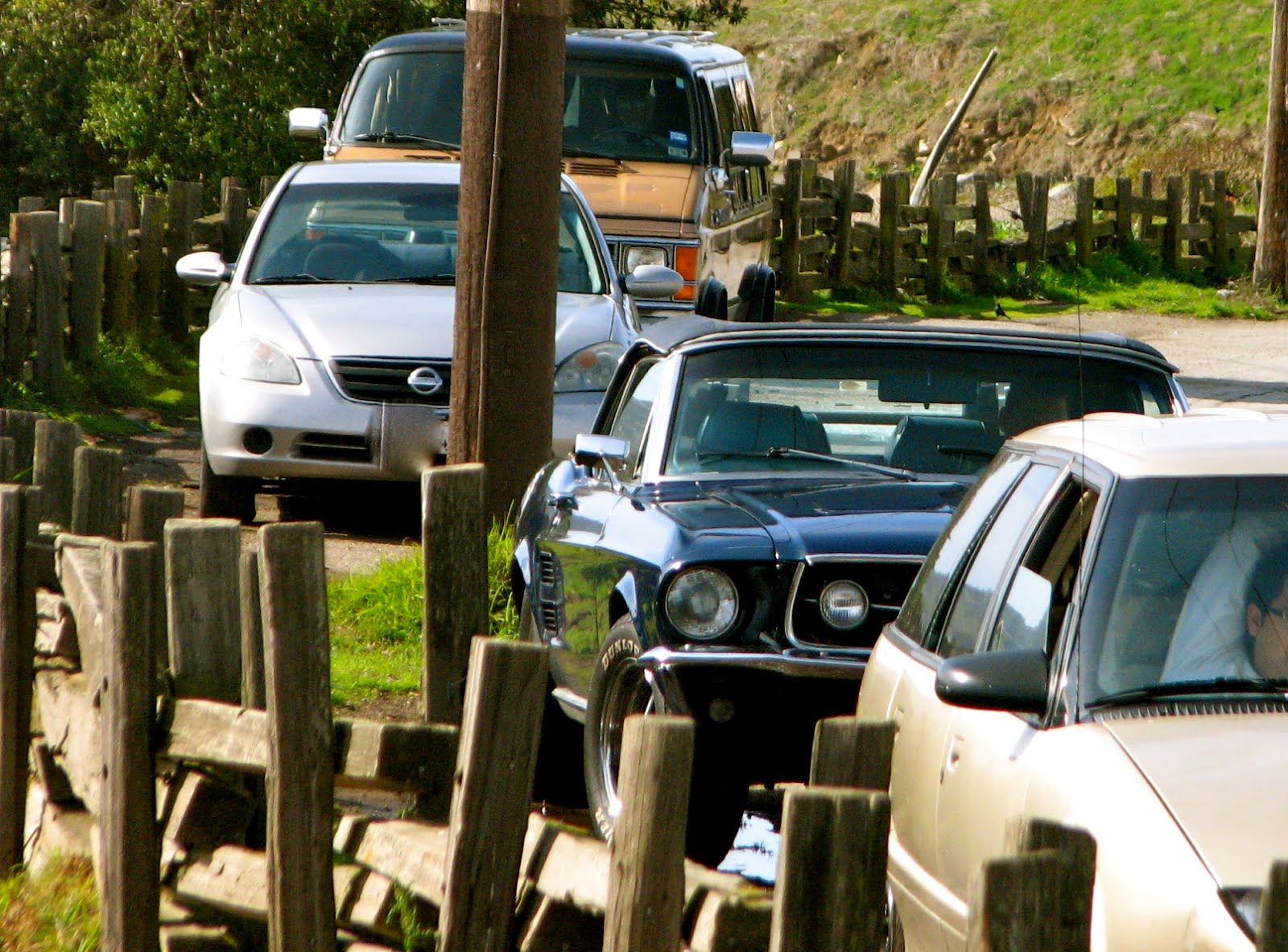
Roxy and I began our two mile, round trip walk around noon. We passed a row of cars parked on the street under "No Parking" signs. The cars were all occupied, no one being foolish enough to leave them unattended in an illegal zone. As we strolled by, the sweet smell of medicinal herb wafted from cracks in car windows. Ah, lunch break!

Our stroll took us around the cove and through a variety of newly blooming wildflowers. The trail offered a handful of exercise stations for those who want a little bit more than a walk for a workout.


The last portion of the path has been painted in happy crayon colors. Lumpy red mounds, lavender serpentine detours and a variety of patterned walkways didn't seem to serve any particular purpose other than... fun!

A strange little angular building marked the end of the trail. There was no information about this tall, slanted closet so it remains a mystery to me.

Roxy and I retraced our steps, walking the mile back to the car. And then I couldn't resist. Candlestick Park was sitting there empty. The Giants moved out a dozen or so years ago and now it is only used for the Forty-Niners football games in autumn. The stadium's emptiness drew me in. I found an open gate and drove through, but the whistle of a security guard called me to turn around.

"Hello," I smiled. "I was just feeling nostalgic. I used to come to baseball games here when I was a kid. My Dad's company had box seats behind home plate," I explained.

The guard smiled back. "Yeah," he said. "My Dad brought me to my first game here in 1965."

"1962 for me. The year they went to the World Series!" I added. He smiled again, nodded and stared. He wasn't going to let me in. Well nothing ventured...

I thanked him and headed to the Highway 101 on ramp, waiting for a Raven to finish munching on road kill before I could get onto the freeway.

I hope to see you at the State Parks.

Lucy

Saturday, February 25, 2012

GARRAPATA STATE PARK: Trip #25 of 70

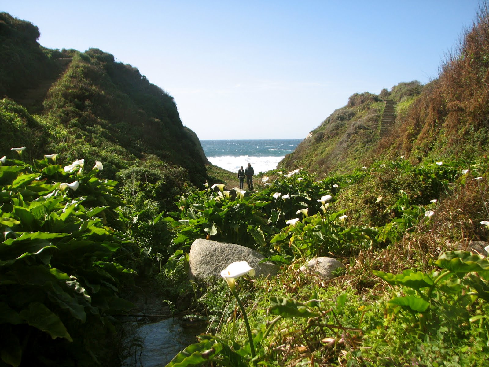
The winter months of January and February have long been known to be the most beautiful time of the year for California's Central Coast beaches. And so it was the day after Valentine's Day at Garrapata State Park, ten miles south of Carmel. Clear skies, wild waves crashing on the rocks, a fresh water lagoon with wild calla lilies and a strong blustery wind graced the day. (More about the wind in a bit!)

Mother Nature had done her work and presented her full color spectrum for my viewing and photographing pleasure. No effort would be required on my part today to get a good picture. I just needed to point and shoot and something gorgeous would be recorded on my camera.

There was no clear indication as to where the park began. The State Park sign was placed behind hillside shrubbery on the westside of Highway 1, making it easy to miss. There was no official parking lot. Sharp eyes had to look for an occasional path down the cliffs to the beach in a turnout on the highway. I drove back and forth over a stretch of three miles, checking out the views and looking for walking paths along the cliffs or down to the beach.

I couldn't resist a small herd of Cows luxuriating in a grass pasture overlooking the ocean. Although they weren't singing or telling jokes (none that I was able to hear anyway), I was certain these must be some of the Real California Cheese Cows.

At another turnout I was able to keep my eye on a Redtail Hawk that flew in of front me, then settled on the bluff, meditating intently on its prey below.

Finally I spotted a trail that had a railing and a stairway leading down to the beach. I parked the car and Roxy and I commenced with our afternoon.

The cliffs were bursting with color. Spring flowers and beach succulents were in full bloom. The contrast with the deep turquoise ocean waters and the lightly clouded blue sky was breathtaking.

Of the parks I have visited to date, Garrapata is the most puzzling from the standpoint of the state budget woes. There was no official entrance that I could find as I followed the parks' own Google Map directions. There was no ranger hut, no pay station, no trash cans, no restrooms. No phone, no pool, no pets... Well actually dogs are allowed on Garrapata Beach! But where do the financial savings come from when this park is closed?

Once on the beach, Roxy and I climbed around on the rocks. But the occasional rogue wave brought the ocean foam a little too close to the edge of cliffs for Roxy's comfort. I could tell she was concerned about being hemmed in.

So, we strolled back to the southern end of the beach. There I leaned against the cliff. With my camera in front of my face I stood and waited for the ninth wave to come crashing over the rocks. The ninth wave came again and again. I found myself happily hypnotized, and remained there for some time.

I watched as a young family confidently hiked past the worrisome boulders and headed north. Clearly they had been here before. They seemed to be purposefully headed to a specific destination. Roxy was calmer now, so, she and I agreed we could make the 100 yard dash through Garrapata's Stonehenge to see what was on the other side.

I'm so glad we did! A most magical place greeted us. A small, freshwater stream flowed from the bluffs, through a ravine and into the ocean. We followed the creek upstream. Within a few yards we were surrounded by an enchanted garden of wild calla lilies. We hopped across small pools of clear trickling water. I swore I heard the faeries giggling!

A pair of young lovers from France (honeymoon perhaps?) strolled into the garden. They lingered for quite some time while he took romantic photos of his lady with the lilies.

A funky old staircase led out of the lilly ravine back up to the top of the bluffs. Here endless paths carry you along the edge of the cliffs through wildflowers or back to the highway. The red and green aloe-like plants, and the red, white and blue succulents presented holiday themed hues. Ceonothus shrubs (sometimes called California Lilac) were bursting with their pale blue blooms. I've often wished I could plant ceonothus at my house, but they wither during the mountain winters.


Roxy and I hiked the cliff trails for another hour or so, enjoying the spectacular aerial views of the sea and her surroundings.


The afternoon waned and we made our way back to the highway. I squeezed into my car. Yes, squeezed. I previously mentioned the high gusty winds. When we first arrived at Garrapata SP, I opened my car door just as a particularly strong gust blew by. It pushed my car door open farther than it was designed to go.

Now the hinge is bent, preventing the door from opening more than a few inches. I've since learned that this a common car ailment for those living on the coast. Well, it's good incentive to stay on my diet until it is fixed!

I can't imagine that a year from now this beach will be inaccessible. I plan to return next winter for more sea magic (good faeries willing.)

Until then, I hope to see you at the State Parks.

Lucy

Friday, January 27, 2012

FORT TEJON STATE HISTORIC PARK: Trip #24 of 70

I highly recommend Fort Tejon State Historic Park for anyone traveling over the Grapevine on Interstate 5 and in need of a driving break or a place for a picnic lunch. It's located right off the highway about three miles north of Gorman (or thirty minutes north of Magic Mountain in case that's more familiar.)

Fort Tejon was first garrisoned by the US Army on August 10, 1854 and was abandoned ten years later. The fort's purported mission was to "protect and control the Indians who were living on the Sebastian Indian Reservation, and to protect both the Indians and white settlers from raids by the Paiutes, Chemeheui, Mojave, and other Indian groups of the desert regions to the south east."

My friends Rosey and Ernie joined me on a sunny January day for a drive through orange groves and a visit to the fort.

There is no ranger on duty at Fort Tejon, and as with many of the closing state parks, paying the day use fee is on the honor system. We all paid, of course. The tour begins by crossing a wooden bridge over the creek, and entering a small museum displaying a cannon, photographs and the chronology of the fort.


The discovery of gold in the 1850s brought confrontations between Native Americans, miners and land-hungry settlers. The US Government tried to ease the conflicts. In 1851 US Indian commissioners negotiated 18 treaties with California Indians, providing reservation lands in exchange for the remainder of the state. White Californians objected so strongly that the Senate refused to ratify the agreements. As Indian leaders had signed away other land in return for protection on reservations, they felt betrayed.

So, the first US Dragoons arrived in the summer of 1854 and began the construc-tion of more than forty buildings for this military outpost. A half dozen of these buildings and replicas remain for the tourist to view. Markers are placed at the sites of structures that no longer exist.

After viewing the small museum, my friends and I began the self guided "Dragoon Walk."

Two small identical buildings sit side by side; one a guard shack, one a crude jail. Army discipline was frequent and harsh. Minor offenses brought solitary confinement or loss of pay.

More serious crimes meant imprisonment with ball and chain or spiked iron collars, and hanging by the wrists or thumbs. In spite of the guard shack being right next door, many prisoners escaped.

Being a guard was no skate through the park either. Shifts were 24 hours and they were required to remain in uniform, even when sleeping. A wooden shelf for a bed in a poorly insulated shack was all the luxury afforded the jail keeper.

The frontier army attracted many immi-grants trying to make a life in the new world. First generation immigrants out-numbered other soldiers by two to one.

The grand Valley Oaks populate much of this flat plateau, some of them as old as 300 years. The usual California critters inhabit the area including songbirds, small mammals, raptors, large predators and of course the ever present rattlesnake. The majestic California Condor sometimes finds shelter in the parks' Valley Oaks. I have seen these magnificent birds before and always have hopes of seeing one again, but today it was mainly jays and woodpeckers. They make me happy too.

The Oaks also shelter the grave of one Peter Lebeck. In 1837, seventeen years before the settlement of the fort, his epitaph was engraved on one of the oaks, Apparently killed by a bear, his companions buried him here and moved on. Not much is known about him. Most likely he was a fur trapper. A group called The Foxtail Rangers placed a proper headstone on his grave in 1938. He remains Kern County's most famous mountain man.

The infamous 8.0 earthquake of 1857 in southern California is often referred to as the Fort Tejon Earthquake. In addition to leaving a surface rupture scar over 220 miles long on the San Andreas Fault, it toppled a number of the buildings at Ft Tejon.


The path led us to orderlies' quarters, officers' quarters, the quartermaster shops and the barracks. Each building displayed furnishings, clothing, weaponry and miscellaneous daily items used by the soldiers and their families.

The barracks also held costumes and weaponry that is currently used in historical re-enactments by The Fort Tejon Historical Society and/or the Student Living History Program , an overnight program geared toward fourth and fifth grade students. As no one is currently stepping up to the plate to bail out Fort Tejon SHP by closure date, these events are only scheduled through June at this time.

Roxy and I explored the Officers' Quarters, entering through an open back door. Captain John Gardiner occupied this building with his wife Annie and their infant son. Examples of furninshings, including a wolf-skin rug, are on display. As we stood in the hallway of their home on this calm, wind-free day, the back door suddenly slammed shut. Well hello there! We love ghosts!

Family sounds mingled with army life at Fort Tejon, giving the fort a small town flavor. Dances, dramas and musical productions were a part of the community.

One of the more unique group of residents at the fort was a herd of camels. The Army had started experimenting with camels for supply transport in the southwest. The camels proved ill suited to the terrain. In 1859 a civilian contractor turned over 28 camels to Ft. Tejon. The post quartermaster cared for the herd until 1861 when they were transferred to the LA Depot. The Camel Corps are mentioned in many writings, but with the possible exception of being used for messenger service once in 1860, they in fact were never used in military operations.

Our Ft Tejon tour was complete and we all wanted lunch. We took a chance on a mom & pop Mexican restaurant - Grullense Mexi-can Restaurant - in the town of Gorman. I had the best nopales y huevos ever! Ernie and Rosey thought their meal was terrific too. Twas the end of a great day, and we were sated with good food and new knowledge as we drove back home through the orange groves of the Santa Clarita valley.

Hope to see you at the parks.

Lucy

Monday, January 23, 2012

PROVIDENCE MOUNTAINS STATE RECREATION AREA: Trip #23 of 70

I knew in advance of my visit to Providence Mountains State Recreation Area that it was already closed, and that in fact the gates to lock up this park were up even before the 70 parks on the closure list were announced last May. Nonetheless, I really do want to get to all 70 parks, and my travels through the desert brought me close enough to the Eastern Mojave to check it out.

Besides, I got the impression from the park's website that while Mitchell Caverns and the campsites were closed, there were still a couple of accessible short hikes.

So, I exited off of Interstate 40 and drove the desolate sixteen mile road toward the park. I did not pass a single vehicle en route. I passed the sign that said "Fee Area Ahead; Self Registration," which is what a number of the closing parks are currently doing. I had hope of a hike.

It was not to be. Right at the sixteenth mile, a gate blocked any further travel down the road. Any temptation to drive around the gate (through the cactus!) was hindered by wire fencing on both sides of the gate as far as the eye could see.

I parked the car in a small dirt turnout. A white sedan was parked there as well, with a fishing rod in the rear back window and a large black trash bag sitting next to it. It was a clear day, and while I couldn't see forever, I could see a long way, and no human being was in sight.

I walked around the gate. Roxy walked under it, stumbling on the grates of the cattle guard. Since I had allowed an hour or two to see what I could see, we began our trek, walking up the middle of the paved road. Obviously we didn't need to worry about traffic. Mountains lions, maybe. I kept Roxy close. Dogs have been known to be attractive, easy prey for the big kitties. As with bears, I enjoying knowing the cats are out there, but prefer not to get any closer than a good zoom lens shot!

The primary attraction at this state park is Mitchell Caverns. In 1932 during the depression, Jack Mitchell, his wife Ida and their three daughters escaped to the East Mojave desert when the bottom fell out of their Los Angeles real estate business. Jack decided to try prospecting, and staked his claim when he found silver deposits in the Providence Mountains. He also found caves.

When the silver deposits proved insufficient to support his family, Jack and Ida created a tourist attraction and campsite around the caves. The venture was a success. He constructed several stone buildings for lodging, one of which served as the park's visitor center until the recent closure. They provided food and guided tours of the caverns until 1954. By all accounts, Jack Mitchell was quite a yarn-spinner. Old-timers still remember his tall tales of ghosts, lost treasure and bottomless pits.

Visitors walked through the two main caves, El Pakiva (The Devil’s House) and Tecopa (after a Shoshonean chieftain) where they had close-up views of stalactites and stalagmites, cave ribbon, cave spaghetti and flow stone. In the early days, tourists had to be nimble rock-climbers who waited for their tour leader to toss flares into the darkness. Later on the caverns became equipped with stairs and special lighting.

I wouldn't be seeing any of that today, though. After walking about a mile, I could see the road curved up into the mountains. There was no sign of any stone buildings.

Aside from a few cactus wrens flitting through the low growing plants, there was very little animal activity. Not as much as a buzzard or raven graced the desert skies. No chirps or caws. No growls or roars. No lizards darting out from under rocks. It was beautifully quiet. I love quiet!

Today I would be satisfied with seeing a goodly number of my cactus friends. Hah! Just I what I need, more photos of cactus. I already have hundreds.

In addition to the creosote - the staple of desert plant life - was plentiful white sage and tumbleweed. Red and golden barrel cactus and the leafy spanish dagger agave created dimension and gave color to the long dry valley. And finally, the jumping cholla cactus made its presence known as I walked further up the road. They had been absence from my desert travels of the past few weeks. They may be my favorite cactus. Often in the sunlight, and especially at dusk, they look as though they are outlined in electric lights. They are beautiful and over the years they've only bitten me once!


Off in the distance against the eastern mountains I spotted some evidence of life. What appeared to be a small clump of RVs rested at the end of a dusty road.

I couldn't decide if it the thought of living in an environment like that made me feel peacefully isolated, or if it just reminded me of an episode of Breaking Bad.

It was time to go. I had a 300 mile drive back to Ventura before days end. I would have surely loved to see those caverns. Who doesn't like to explore caves? If Providence Mountains State Recreation Area ever reopens I will most certainly return. The high desert is a favorite place of mine in the winter.

Over the past few months as I've talked with folks about my State Park travels, a number of people have commented how "they" can't really keep people out of the outdoor parks, even when gated. And while this is true, I would have had to walk at least a couple of more miles before getting to the official park entrance at Providence Mountains. The same applies to other parks I've visited, like Castle Crag and Palomar Mountain. You can park your car along the road and walk in, but it will generally add 4-6 miles of walking on pavement before getting to the hiking trails. I doubt the average day-tripper would be inclined to do so.

My vote is for no gates!

I hope to see you at the parks.

Lucy